The LandSeaLot Integration Labs (LILs) will support LandSeaLot’s mission to develop an observation strategy along the Land-Sea Interface (LSI) as testing centres designed to pilot the proposed actions and improvements derived from the project as well as to inform a community-based observation strategy in selected regions. The LandSeaLot Integration Labs will be dynamic testing grounds and will provide insights into the feasibility and challenges encountered to ease the development of The LandSeaLot Common Observation Strategy.
The LandSeaLot Integration Labs (LILs) will address the main land-sea interface societal challenges: 1) assessment of lateral carbon fluxes and marine carbon stocks, 2) prediction and adaptation to climate change threats and 3) reduction of land-based pollution and conservation of biodiversity. This will provide improved models and forecasting capacity.
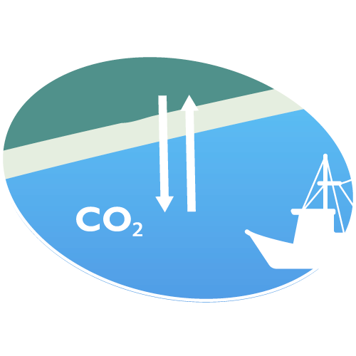
Assessment of lateral carbon fluxes and marine carbon stocks
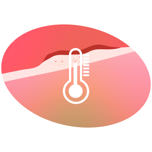
Prediction and adaptation to climate change threats

Reduction of land-based pollution and conservation of biodiversity
LandSeaLot links together expert participants focusing on solutions for improved data integration, the implementation of low-cost observation technology and citizen engagement and data management. It leverages tested, improved, and guided low-cost technology to empower citizens to actively contribute to the land-sea interface observation capacity. Through continuous feedback loops, the LandSeaLot Integration Labs fuel LandSeaLot’s mission to uncover best practices, shaping a common observation strategy for the future.
In total, nine LandSeaLot Integration Labs (LILs) in Europe have been selected to cover all European regional water bodies (Baltic, Mediterranean, and Black Seas, the North Sea and English Channel and the Atlantic coastal area), across important riverine systems and coastal landforms (deltas and estuaries, micro- and macro-tidal coasts).

Building a digital observatory towards a fully developed digital twin, this LandSeaLot Integration Lab will focus on carbon landscapes, water quality and quantity across the catchment to coast continuum. It will utilise next generation sensors and sensor networks, contributing to interoperability, data assimilation and data fusion. It will also focus on floods from land and droughts, building on existing capabilities, integrating data (Synthetic-aperture radar (SAR) & optical Earth Observation, in situ data from echo-sounding, tide gauges, wave and water quality buoys, above water radiometry, soil moisture, hydrodynamic and hydrology models, low-cost water level sensors), in order to understand the full water continuum.
Evaluating the Baltic carbon budget faces uncertainties due to carbon influx from land. This LandSeaLot Integration Lab will conduct integrated data analysis using improved EO (Earth Observation) algorithms, coupled with numerical models (VEMALA, COHERENS, SEABED, + FICOS), automated and manual in situ observations and isotope analysis to qualify and quantify carbon fluxes at river mouths. It will also evaluate the impact of heatwaves on cyanobacteria blooms and dissolved carbon degradation by coupling merged EO SST products and in situ low-cost temperature observations with biogeochemical observations.
The Wadden Sea and adjacent rivers experienced major changes in carbon and nutrient dynamics over the past four decades. Recent research showed that these variables are still changing. Using observation and modelling capabilities from three different Research Infrastructures (ICOS-ERIC, DANUBIUS-RI, JERICO-RI), this LandSeaLot Integration Lab will demonstrate the benefits of integrating enhanced data-model (in situ and remote sensing) across the land-sea interface for better understanding lateral carbon and nutrient fluxes and stocks. It will use improved versions of existing models from DLT (DCSM-FM) and HER (SCHISM-ECOSMO), connecting them to plans from the community fora and pilot methods for integrating satellite data, to develop a coastal water component in ICOS-ERIC. River nutrient and carbon data will be evaluated and made available in an open source data format.
The Seine LandSeaLot Integration Lab is highly impacted by nutrient inputs from the catchment areas and heavy engineering work done to promote maritime traffic and economic development along the Seine estuary. Their impact on the ecosystem functioning will be investigated, including phytoplankton bloom dynamics, sediment fluxes and morphological evolutions and habitat modifications. The LandSeaLot Integration Lab activities will include:
Three Research Infrastructures (DANUBIUS-RI, JERICO-RI, ICOS-ERIC) in the area will team up in this LandSeaLot Integration Lab to assess lateral carbon fluxes from its distributed riverine system and to address flood risk from sea due to storm surges and increased saltwater intrusion, which impacts the Po River delta. These are major environmental and socio-economic threats (e.g., water supply, agriculture). The LandSeaLot Observation Lab will test the coupling of data streams from fixed instruments and Earth Observation imagery, improvements of the existing storm-surge model (SHYFEM and WW3) through assimilation techniques and Earth Observation algorithm development in order to obtain a surface salinity proxy based on field data and high resolution Earth Observation.
This LandSeaLot Integration Lab will focus on the coastal sediment budget development under combined human/climate pressures and inputs of pollutants from the Danube River to the North-West Black Sea through the delta. With its facilities and established stakeholder communities and synergy with ongoing projects in the area (H2020 CERTO and H2020 DOORS), DANUBIUS-RI will support the action to fill observation gaps, thus integrating information from numerical models at the catchment and coastal scale and with in situ and remote sensing data.
This LandSeaLot Integration Lab, as part of a JERICO-RI region, engages experts from several disciplines to evaluate carbon budgets and partial pressure of CO2 (pCO2) fluxes in these highly variable regions of river plumes and adjacent areas, which are strongly impacted by climate change and pressures from human activities. Neural network methods integrating simulations of the physical-biogeochemical model (e.g., SYMPHONIE), satellite SST and Chl-a products and in situ observations will be piloted to provide a combined information product on CO2 budgets ranging from the river mouth to the coastal sea.
This LandSeaLot Integration Lab will focus on heat waves and flooding effects making full use of low-cost sensors (temperature and water level) to fill gaps along the land-sea interface and quantify impacts on the local ecosystem and hence on the ecosystem services provided to the benefit of society. It will be supported by the engagement of citizen organisations, marinas and local stakeholders. The satellite observations will be integrated with data from numerical models and low-cost sensors aimed to improve resolution and accuracy.
This area is strongly threatened by plastic and nutrient pollution due to the human pressure on catchments and inputs from the Dardanelles straits. NA LandSeaLot Integration Lab is supported by JERICO-RI, ICOS-ERIC, DANUBIUS-RI and national (HIMIOFOTS) research infrastructures and facilities to evaluate integrated approaches to inform on plastic pathways from rivers to the sea and on the effect of nutrients inputs on the trophic status of the ecosystem. It will link low-cost observation systems and citizen actions together with numerical Lagrangian simulations which will be improved by Earth Observation products assimilation.


LandSeaLot has received funding from the European Union’s Horizon Europe Framework Programme for Research and Innovation under grant agreement No 101134575. Views and opinions expressed are however those of the author(s) only and do not necessarily reflect those of the European Union or European Research Executive Agency. Neither the European Union nor the granting authority can be held responsible for them. UK participants in Horizon Europe Project LandSeaLot are supported by UKRI grant numbers: 10109592 University of Stirling and 10107554 Plymouth Marine Laboratory.
©2024 LandSeaLot | Privacy Policy | Cookie Policy | Website by Seascape Belgium
To provide the best experiences, we use technologies like cookies to store and/or access device information. Consenting to these technologies will allow us to process data such as browsing behavior or unique IDs on this site. Not consenting or withdrawing consent, may adversely affect certain features and functions.